
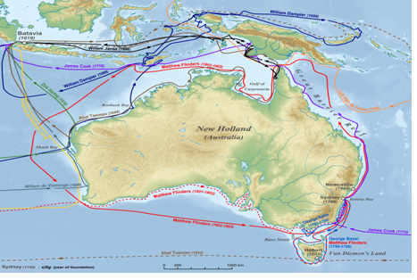

In the early nineteenth century, Australia remained largely uncharted, and doubt prevailed as to its unity as a continent. The 1801 expedition led by English mariner and cartographer Matthew Flinders (1774–1814), was groundbreaking in this respect. Flinders’ charting of the Australian coastline provided the first complete map outlining the continent, and his influence was decisive in changing its name from Terra Australis to Australia – a term ‘more agreeable to the ear’. Structured around daily geographical and astronomical observations, Flinders’ journals – published in 1814, the day before his death – are remarkable for their humanity and sense of humour. Started in 1801, they continue to include Flinders’ imprisonment by the French in the island of Mauritius between 1803 and 1810. The second volume tells of the discoveries made along the east and north coasts of the continent, and includes an account of Flinders’ captivity. An appendix details botanical discoveries.